It outlines who can complete an EC, how FIRMs are produced under Risk MAP, and practical steps to obtain and use an EC for insurer rating or FEMA map amendment requests. The goal is to give clear, source-based next steps without legal or financial advice.
flood insurance NFIP explained: what an Elevation Certificate is
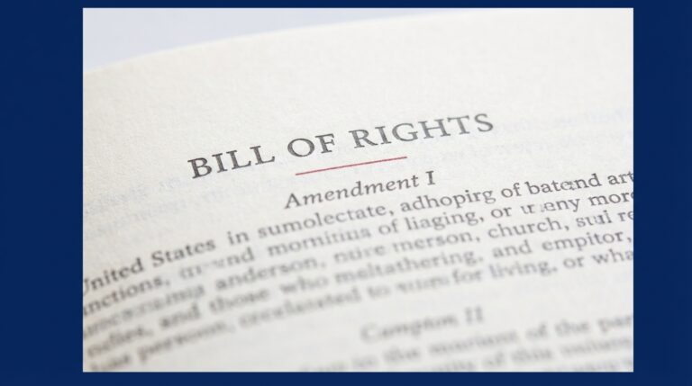
The phrase flood insurance NFIP explained applies directly to the role of FEMA’s Elevation Certificate, the standardized NFIP form used to document a building’s elevations relative to the Base Flood Elevation. The Elevation Certificate helps insurers and communities set flood insurance ratings and determine eligibility by showing measured building elevations and enclosure details, as required on the FEMA form and instructions FEMA elevation certificate form and instructions.
The EC collects specific fields used for rating, including the lowest floor elevation, lowest adjacent grade, and enclosure details. Insurers rely on those certified measurements when they calculate premiums or consider exceptions that may change a property’s rating.

Because the EC is accepted by communities and by the National Flood Insurance Program, a properly completed form can be the primary piece of certified evidence used for both insurance rating and for requests to change a map status when warranted.
Property owners often ask how an elevation certificate works and when it is required. In short, the EC documents the vertical relationships the NFIP uses to classify a structure’s exposure and whether building features qualify for different rate categories.

Who can complete an Elevation Certificate and what credentials matter
Only credentialed preparers should complete the EC. FEMA allows licensed surveyors, professional engineers, or local officials authorized by the community to fill out and sign the form, because several EC fields depend on certified, measured elevations FEMA elevation certificate form and instructions.
When you hire someone for an EC, check they hold the license or credential your community accepts. Many insurers will not accept an EC signed by an uncredentialed preparer, and local floodplain offices typically publish who they accept to certify elevations.
Practical credential checks include verifying the license number with the state licensing board, asking for proof of professional liability insurance, and confirming that the preparer has recent experience with NFIP ECs. The Association of State Floodplain Managers also summarizes who can complete ECs and how they are typically used ASFPM guidance on elevation certificates.
How Flood Insurance Rate Maps and Risk MAP produce FIRMs
FEMA produces and updates Flood Insurance Rate Maps under the Risk MAP program, which aims to combine technical analysis with community engagement so maps reflect local conditions and risks. Risk MAP brings together digital topography, hydrologic and hydraulic studies, and local input to create or revise FIRMs FEMA Risk MAP overview.
Technical inputs used in FIRM production include high-resolution topographic data such as lidar, hydrologic modeling of stream flows or storm surge scenarios, and hydraulic modeling that maps how water moves across terrain. Community-submitted information and local studies also feed the map update process, and that input can change how a zone or BFE is drawn.
Quick checks to find effective FIRMs and Risk MAP resources
Check FEMA and NOAA pages for the latest map products
Because FIRMs are periodically revised, the effective map date matters when you evaluate insurance requirements and whether a revision might apply to your property. FEMA provides a public set of FIRM products and a process for map appeals and formal revisions.
How an Elevation Certificate can affect NFIP premiums and eligibility

An EC can reduce an NFIP premium when it documents that a structure’s lowest floor or lowest adjacent grade is above the community Base Flood Elevation, but the precise rating change depends on NFIP rules and the building’s features. A certified measurement that shows elevations above the BFE is the core evidence insurers use to consider a lower rate FEMA NFIP rating and underwriting guidance.
Not every EC that shows a higher elevation will produce a big premium change. Rating rules take account of enclosure conditions, whether utilities and mechanicals are elevated, and other building characteristics. Community-level factors, like participation in the Community Rating System, also affect premiums.
When evaluating potential savings, treat EC outcomes as conditional. The EC supplies certified elevation data; insurers apply that data using program rules to reach a final premium calculation.
When and how to get an Elevation Certificate in practice
Start by contacting either your insurer or the local building or floodplain office to learn whether an EC is likely to change your rating. Many communities maintain lists of licensed surveyors or offer certified measurement services through the local office.
Order an EC when your property is in a mapped flood zone, there is uncertainty about the lowest floor elevation, you are preparing a sale or refinance, or when a rating review or map amendment could change insurance requirements.
Typical steps to order an EC include selecting a licensed surveyor or engineer, agreeing a scope that specifies datum and deliverables, arranging site access, and having the preparer record the required measurements and fill the FEMA form. After completion, the EC should be submitted to your insurer to request a rating review, and it can be used as supporting evidence for a FEMA map amendment if needed ASFPM guidance on EC use.
Keep records of the EC, photos taken at the time of the survey, and any survey plats. Those documents speed insurer reviews and are essential if you pursue a LOMA or LOMR from FEMA.
Map corrections and amendments: LOMA and LOMR basics
A Letter of Map Amendment, LOMA, is a property-specific determination by FEMA that a particular structure or parcel is above the BFE on the currently effective FIRM. A Letter of Map Revision, LOMR, is a formal change to the map data that typically follows a more extensive technical review and may revise flood zones or BFEs for a larger area FEMA FIRM FAQs and map revision processes.
Elevation Certificates and other certified evidence are commonly used to support LOMA requests when property-specific data show that the structure’s lowest adjacent grade or lowest floor is above the mapped BFE. For broader map changes, LOMR requests usually require more detailed hydraulic or topographic analyses.
A successful LOMA or LOMR can remove a mandatory purchase requirement for flood insurance or change a property’s zone, but outcomes depend on the evidence quality and the specific technical review FEMA performs.
Decision checklist: should you order an Elevation Certificate?
Is your property in a mapped flood zone, is there uncertainty about the lowest floor elevation, or are you preparing a sale or refinance? If the answer to any of those is yes, an EC can be useful. Also check whether an existing EC or survey already documents elevations before ordering a new one.
Check the effective FIRM date for your area, confirm whether the community participates in the Community Rating System, and review local ordinances that might require higher elevation standards. These community factors influence whether an EC will change premiums or map status NOAA guidance on flood map change requests.
Join Michael Carbonara's Campaign to Stay Informed
Please check your effective FIRM date and contact your insurer to ask whether a certified Elevation Certificate could change your premium or eligibility.
Weigh cost against probable benefit. If you are close to the BFE, an EC often provides relevant evidence. If you are clearly well above or clearly below the BFE, the EC may only confirm what is already known.
Common mistakes and pitfalls when using Elevation Certificates
Submit only a completed EC signed by an authorized preparer. Missing required fields, incorrect datum references, or a signature from someone without appropriate credentials can make an EC unacceptable for rating or map amendment requests FEMA elevation certificate form and instructions.
Check the effective map date before relying on an EC for a rating or a LOMA. If the FIRM used for comparison is outdated relative to the property situation, you may face delays or find that additional evidence is needed. Always document photos and survey plats when you submit requests for rating changes or map amendments FEMA Risk MAP and map update guidance.
Another common problem is not agreeing a clear scope with the preparer. Ask that the datum, vertical reference, and the EC sections to be completed are specified in writing before work begins.
How local ordinances and Community Rating System participation change outcomes
Local floodplain ordinances can require higher freeboard or different elevation practices than the FIRM alone. That means even if an EC shows compliance with the FIRM, the community may require elevations above those minimums for local permits or for the community to remain in good standing with floodplain management standards FEMA FIRM FAQs and map revision processes.
The Community Rating System offers CRS credits to communities that implement floodplain management activities, and communities with higher CRS classes usually deliver measurable premium discounts to their residents. That local premium effect can change whether an EC’s rating benefit is large enough to justify the cost.
Before relying on an EC outcome, check your local ordinance for freeboard requirements and confirm your community’s CRS status with the local floodplain office or the community webpage.
Practical example scenarios: how an EC can change an insurance outcome
Scenario A, possible premium reduction: A certified EC shows the lowest floor is above the BFE by a modest margin and the enclosure is sealed or meets NFIP elevation rules. In this scenario, the insurer may reclassify the structure to a lower rate category, subject to program rules and verification of enclosure details.
Scenario B, no effect: An EC confirms the structure is well below the BFE or shows noncompliant enclosure conditions. The EC documents the condition but does not change the required rating or mandatory purchase status.
Scenario C, map correction support: An EC combined with survey plats and topographic data may support a LOMA if the property was inadvertently included in a floodplain on an earlier FIRM. Each scenario depends on the EC fields, NFIP rating rules, and any broader map revision work FEMA may require FEMA FIRM FAQs and map revision processes.
What to submit to your insurer and to FEMA for rating or map changes
For insurer rating reviews, provide the completed EC, clear site photos showing the building and its adjacent grade, and any survey plats that document property elevations. Deliver these documents directly to the insurance agent or company as part of a rating review request.

For FEMA LOMA or LOMR requests, submit the certified EC along with survey plats, legal descriptions, and any supporting topographic or hydraulic evidence FEMA requests. High quality documentation and certified provenance speed review and reduce follow-up questions FEMA FIRM FAQs and map revision processes.
Maintain copies of everything and record submission dates and any case or reference numbers provided by your insurer or FEMA office.
Costs, timing, and finding credentialed professionals
Factors that affect cost and timing include property complexity, site access, and local surveyor rates. Simple parcels with direct access often take less time and cost less than complex waterfront or multi-structure properties.
When comparing bids, ask for a written scope that lists the datum and vertical reference, the EC sections to be completed, the deliverable format, and an estimated turnaround. Verify the preparer’s license with the state licensing board and confirm local community acceptance before hiring ASFPM guidance on EC practitioners.
Get at least two bids for comparison and pick a provider who supplies a written timeline and certifies the use of NFIP EC standards.
Next steps for homeowners: a simple action plan
First, check the effective FIRM date and zone for your address. Then confirm whether your community participates in the Community Rating System. These checks help set realistic expectations about whether an EC will change premiums or map status FEMA Risk MAP overview.
Second, contact your insurer and ask whether they will accept a newly completed EC and whether they anticipate a rating review if you submit one. Third, contact the local floodplain office to ask for lists of accepted preparers or local measurement services.
Finally, if you proceed, get a written scope from the preparer that includes datum, deliverables, and turnaround, and request copies of photos and survey plats so you can reuse them for future requests or transactions.
Conclusion: key takeaways and where to find primary sources
FEMA’s Elevation Certificate is the NFIP standard for documenting building elevations and is widely used by insurers and communities to set flood insurance ratings and to support map amendment requests. Verify preparer credentials and the effective FIRM date before commissioning or relying on an EC FEMA elevation certificate form and instructions.
For primary documents and tools, consult FEMA’s EC form and instructions, FEMA Risk MAP materials, the FIRM FAQs and revision procedures, ASFPM guidance, and NOAA resources on flood map change tools. These sources outline forms, map production methods, and practical steps for map corrections.
Licensed surveyors, professional engineers, or local officials authorized by the community may complete the FEMA Elevation Certificate. Verify license and community acceptance before hiring.
Not always. An EC can lower premiums if it documents the lowest floor or adjacent grade above the BFE, but the final effect depends on NFIP rating rules, building features, and community factors.
A LOMA is a property-specific determination that a parcel or structure is above the BFE on the effective map, while a LOMR is a formal revision to the map data that can change zones or BFEs for a larger area.
Primary sources such as FEMA's EC form and instructions, FEMA Risk MAP materials, ASFPM guidance, and NOAA map change tools are the authoritative places to verify procedures and forms before you act.
References
- https://www.fema.gov/flood-maps/tools-resources/elevation-certificate
- https://michaelcarbonara.com/contact/
- https://www.floods.org/what-is-an-elevation-certificate/
- https://www.fema.gov/flood-maps/products-tools/risk-mapping-assessment-planning
- https://michaelcarbonara.com/
- https://www.fema.gov/assistance/individual/programs/financial/flood-insurance/manual
- https://coast.noaa.gov/digitalcoast/tools/flood-map-change/
- https://www.floods.org/resource-center/elevation-certificate/
- https://www.floodsmart.gov/get-insured/elevation-certificates
- https://www.fema.gov/pdf/library/elvcert.pdf
- https://www.fema.gov/flood-maps/products-tools/flood-insurance-rate-map
- https://michaelcarbonara.com/about/